Planning for Hendersonville bike and pedestrian facilities began in 2000 Bike/Ped Master Plan. The 2005 Hendersonville Tomorrow Committee (HTC) updated it. The City's 2009 Land Use and Transportation Plan offered supporting policy. In 2010 the City built its greenway according to these plans. Members of the HTC continued in an unofficial advisory capacity.
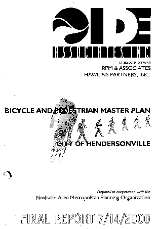
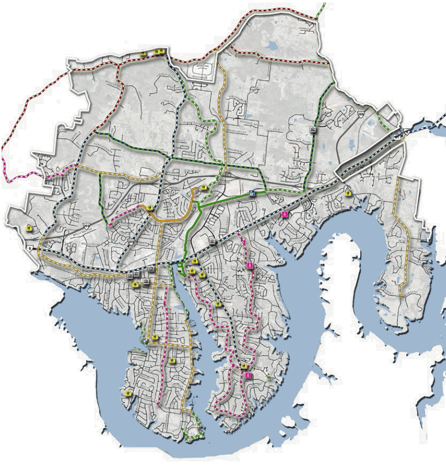
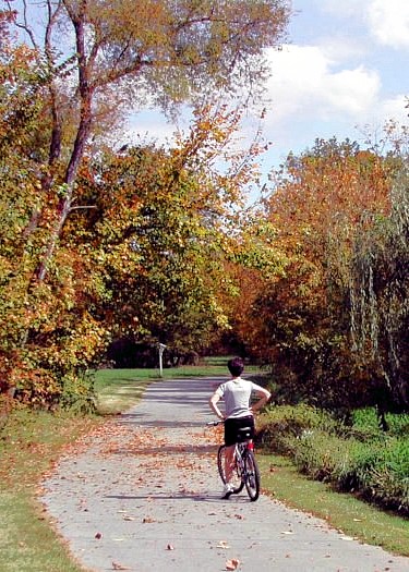
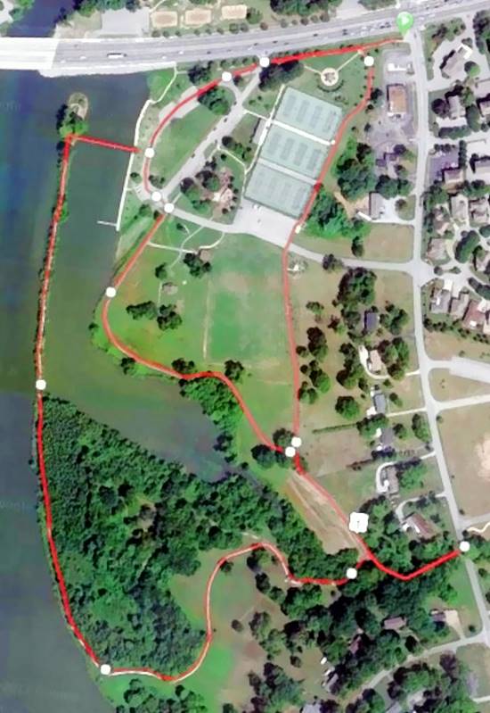
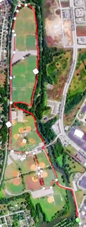
Work on Hendersonville’s Greenway Trail network began in 2000 with the Bicycle and Pedestrian Master Plan drafted in cooperation with the Nashville Metropolitan Planning Office. In that year the city received Federally-funded Transportation Enhancement Grants to construct the short (less than two miles in length) trails in Memorial and Drakes Creek Parks. In addition to that funding it also received money for the sidewalks around Hendersonville High School and Nannie Berry Elementary School.
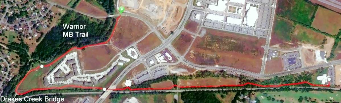
Around 2010 as part of the Halo construction of the Indian Lake Streets Commercial and Residential development, the City added the Indian Lake Streets Greenway. This trail system connected via a bridge over Drakes Creek to the north side of Drake’s Creek Park and ran north connecting to Veterans Park with a second bridge over the creek.
This trail also ran east along the CSX rail line passing the Hendersonville Library and connecting to the deserted spur Stop 30 road. The latter road runs along the east edge of Blue Grass County Club golf course and eventually accesses to the Sumner County YMCA.
Ever since Hendersonville built its first greenway trails, it has wanted to build a greenway trail along the western shore of Drakes Creek/Old Hickory Lake. It would provide access to Sanders Ferry Park at the southern tip of Sanders Ferry Road. The City has received over three million dollars in grants but has been unable contract out even the initial mile south from Gallatin Road.
Likewise the City has also submitted plans for obtain funding to connect its Indian Lake Greenway to the Hendersonville spur of the Lower Station Camp Greenway.
It is unlikely that either of these projects will ever come to fruition.
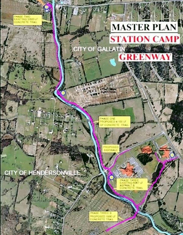
The Station Camp Greenway trail network runs along the northest border of Hendersonville from the southern spur in Hendersonville at Cannons Crossing to the Clark House at Long Hollow Pike in the north. It runs parallel to Lower Station Camp Road includes two large bridge crossings over Station Camp Creek. Sections of the trail run along the southern edge of the school campus over to Big Station Camp Road.
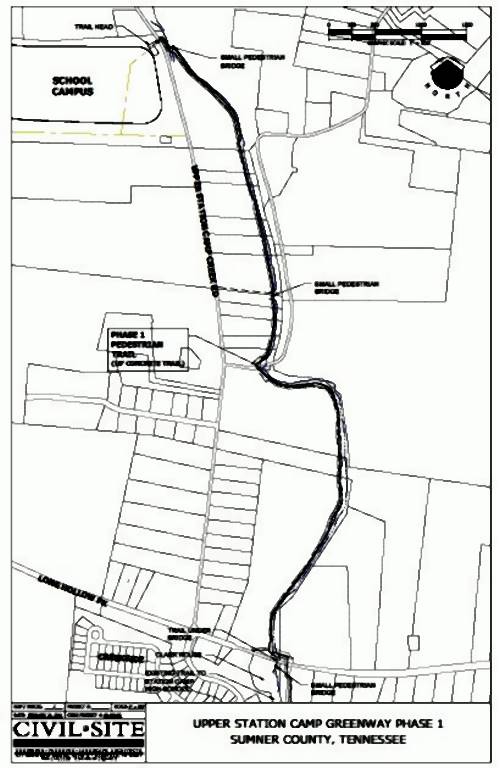
Plans have been drawn to extend the trail system further north of Long Hollow Pike to the new school complex on Upper Station Camp Road.